
Unique, detailed settings galore: Real super secret trick of the trade # 3
/This tip is obvious on first inspection but using it to its full potential is an art form
How long do you spend drawing maps and sketching out buildings? Most writers either spend a lot of time on this or their settings are sorely lacking in detail. I've drawn my share of maps and sketched quite a few buildings, but there is a shortcut that will get you there a lot faster. It will do a few other things besides. And you already know what it is and have probably used it many times for other purposes.
Here's a short list of the things I use either GoogleMaps or GoogleEarth for while writing and the reasons why one or both is almost always open on my desktop:
Imabe by Simon Ledingham of the Geographic Project Collection
1. Real settings: If you are writing about a setting in the real world, it's pretty obvious that you're going to want to have a map and pictures of it handy while you write out your first draft and when you edit. You've got to get distances right and check for street names, but you also want to include details of the landscape and buildings. If you're writing about a real location, even if you have been there, open up GoogleMaps and refresh your memory. You'd be surprised how many more details reemerge when you see the landscape around your location. You know the key to getting your reader engrossed in the story is often in the use of sensory details. Take a look at the pictures and if you've been in a place with similar plants and climate, remember how it smelled. What would that city street feel and sound like? I write a lot of scenes in real places because even though my books are fantasy, they're set in the contemporary world and the realism of the settings adds to the plausibility and suspense of the story.
2. Fantasy settings: But I've written fantasy locations as well and GoogleMaps is just as good for that. There is no need to draw a map from scratch and fill in every detail even if your world is complete fantasy. Use GoogleMaps like a template. Is your world desert? Fine. Find a large desert and use the distances, types of rock formations, water sources and habitations to make a realistic map of your world. Change a few things and voila, you've got a fantasy desert with a lot more detail than you could generate on your own. As you describe your character's movements, use the close views on GoogleEarth to grab details of the landscape. Need a cityscape? The same can be done. Look at the street view and imagine how the city of your fantasy world would be different. But choose a part of a city that is at least close and that way you'll have the basic layout already.
3. Planning action scenes: At one point I knew I needed a bridge. It had to be a two-lane freeway with not much in terms of railings, so that one of my characters could leap off in desperation. And it had to be high enough for that to be dangerous but not high enough to make survival impossible. And it had to have at least a low wall in the center for my other characters to take cover behind in a gun battle. I assumed I was going to have to choose a river and invent my own bridge, but I actually found the perfect real-world bridge in Portland, Oregon on GoogleMaps and once I had a real bridge coordinating the scene realistically and plotting the aftermath was relatively easy. Even if the building, street, mountain, bay or bridge that you choose for your scene isn't in the location you say it is or is really pure fantasy, choose a look-alike location on GoogleEarth, get into the detail mode and imagine your scene on location. The details and the physical movement of action scenes will go much more smoothly.

4. Coordinating distance, time and plot: If your plot requires characters moving from one location to another and arriving at a particular time, let alone if more than one group must move and arrive at the same time, you need to plot the movements and time on a map. (I know you may think your scene is simple enough to avoid this step, but please take it from someone who tried that a lot of times and had to backtrack every time due to a need for details. If you plot the movements on a map, you will have a much easier time keeping details accurate and evocative.) You can do this by hand but is is grueling. Better, grab an area with enough similarity to your fictional setting on GoogleMaps and plot the movements there. Are your fantasy heroes on foot through the Great Kierlap Mountains and the villains racing on horses across the plains of Umthrak both heading for the city of Fallem? There are plenty of mountains and plains that intersect with a city in the real world. And you can get distance and time estimates for travel on foot as well as by bicycle and car. (Google, would you please add horses!) Note that distances and time on foot will still be calculated based on roads. But this actually helps a great deal. Even in a world of wilderness, your characters won't be going in a straight line. They'll be following winding trails or at least the bottoms of canyons. Use the time and distance calculations as a guide and adjust appropriately. This helps to keep estimates of time and distance realistic and to keep directions consistent over long plot sequences.
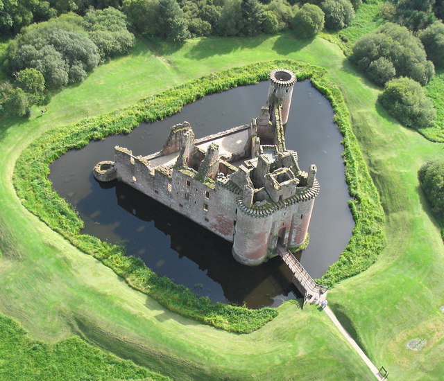
5. Easy variety and detail in dwellings and other buildings: When you're using GoogleEarth and GoogleMaps, don't forget that most buildings can be transferred to another location in your imagination. If you need a medieval castle in your landscape, go find one. A real one. If it is partly in ruins or you simple don't like part of it, change it, and sketch a new one. But having a real one to look at from the air before hand will be immensely helpful in making your castle realistic. You may also not need anything out of the ordinary. Maybe you just need a suburban house but you want to describe it well. You could use your house, if you live in the right neighborhood, but what about the next book? You could also make up all those details, but you're going to start repeating yourself eventually. GoogleMaps provides you with endless possibilities of buildings to describe. And when you're writing about imaginary locations, you can use any building and keep a 3D picture of it handy on your desktop for evoking detail and planning scenes.
Note 1: You'll notice that I use GoogleMaps and GoogleEarth almost interchangeably. They aren't exactly the same. GoogleMaps.com is a website and you can use from any kind of internet connect. GoogleEarth is a program that you can download onto your computer. The basic version is free. I find it easier to find locations and get directions and estimate distance and time on GoogleMaps. I find GoogleEarth has better access to street view and more photographs of specific places. Obviously they are really the same thing but I use both. You could probably get by with on or the other depending on how complex your setting isl
Note 2: Just in case anyone misunderstands this, I am not suggesting that you should copy Google's maps to make your own map. Don't plagiarize. This is not about making a map to put in your book. This is about using a working and interactive map to plan out the details of your scenes and plot. If you need to draw a map to put in your book, that's another process entirely. You can draw a map, hire someone or buy software that will help you draw realistic maps.